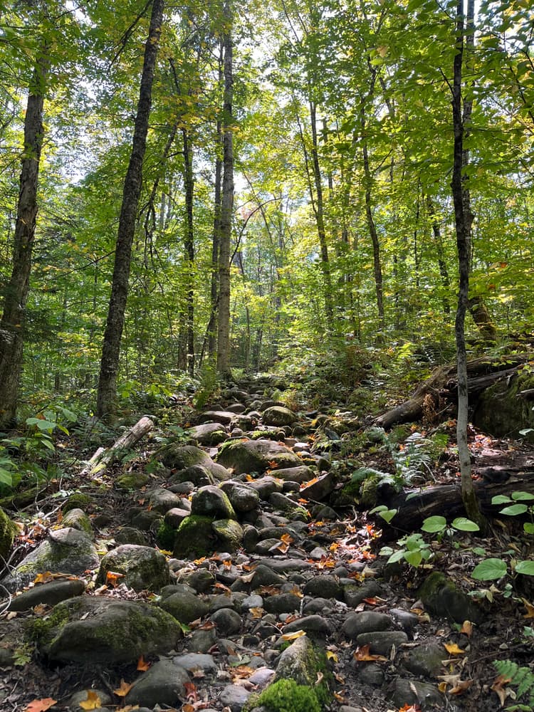
This portage trail is not only an outstanding hiking experience through wild Central Maine woodlands, but an adventure in retracing our Revolutionary War heritage. In retracing the route, the hiker is following in the footsteps of centuries of Native Americans use and also following the same route as used by our brave Revolutionary forefathers.
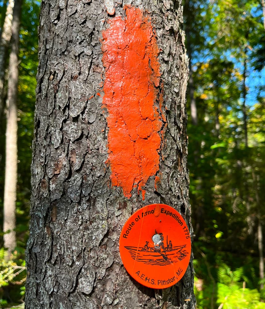
The trail is marked by orange blazes, except for the section of the AT which is marked by white blazes. There may be a question as to which direction would be the best to hike, east to west or west to east. Either is a fine hike! However, to more closely emulate the experiences of the soldiers of the 1775 Expedition, the better way is east to west, Wyman Lake (Kennebec River) to Flagstaff Lake (Dead River).
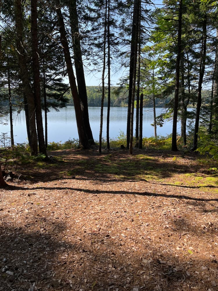
The route can be hiked as a one day experience, a moderate 12 miles in length. But for those who want to take two days to hike it, an AEHS campsite by Middle Carry Pond could be utilized (reservations are required, via emailing AEHS).
When you take a quiet break along the trail, listen carefully for the clandestine shouts and talk of the soldiers of the Expedition. Although their footsteps have been long erased, the spirits of these brave soldiers are still heard along the way.
In the distant past, Native Americans had developed an elaborate system of travel routes along Maine’s many waterways. Just after the ice age, people ranged north, deep into the interior as far as the Forks of the Upper Kennebec River, Moosehead Lake, and further north.
More modern Native Americans developed a route for the Atlantic coastal dwellers to reach the St. Lawrence River villages. This route utilized two rivers, the south-flowing Kennebec and the north-flowing Chaudiere. The route ascended the Kennebec, surmounting four relatively short portages around prominent falls. There were several native villages along this section of the river. However, when natives ascending the river reached a point near the present day village of Caratunk, the river became very difficult to navigate, becoming a continuous series of rapids, fast water, and several huge waterfalls.
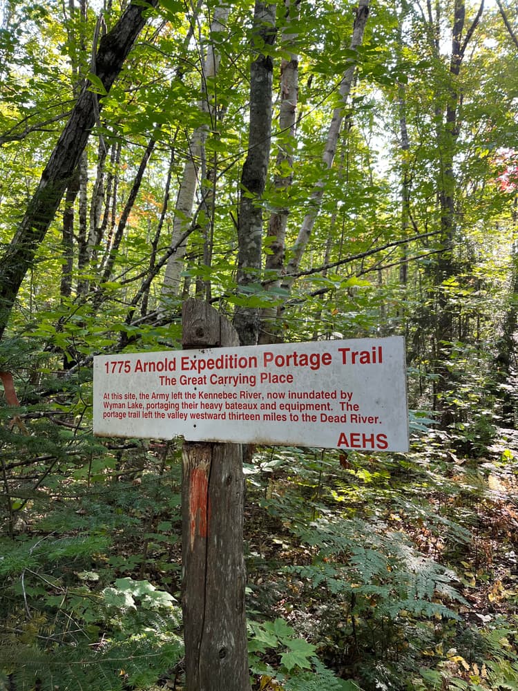
To avoid this almost impassable stretch in their fragile birch bark canoes, the Native Americans discovered a 13 mile portage that lay almost due west. It rejoined the Kennebec’s West Branch, now called the Dead River. This long portage avoided the huge 700-foot rise in elevation, which caused the river above Caratunk to be dangerous to ascend or descend. Once the Dead River on the west side of the portage was reached, the river was much more navigable.
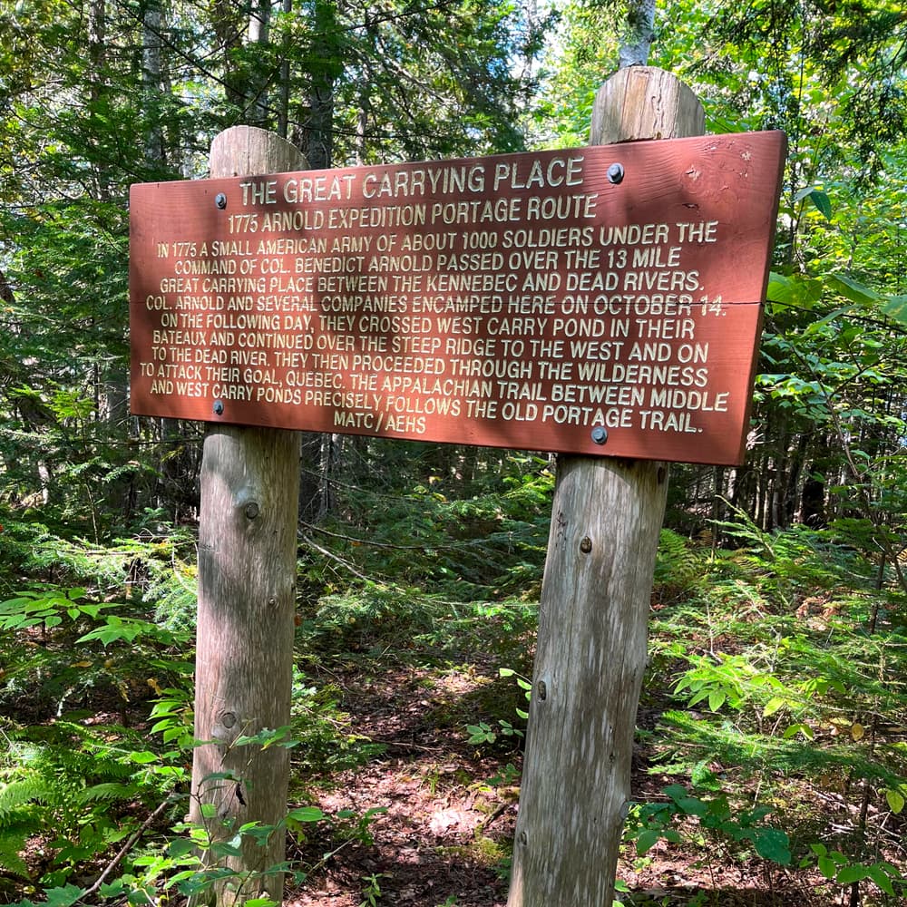
This portage, because of its length and difficulty, was named by Native Americans the Great Carrying Place. Later, English settlers adopted it as well. Luckily the portage utilized three small ponds, shortening the land portion of the route. After about 1636, French Jesuit Priests often used this route to reach Native American villages along the Kennebec. How many centuries the route had been utilized prior to the arrival of Europeans is not known.
In 1763 an English army engineer named Montresor was sent to explore this route from Quebec City to the Atlantic coast. He documented the route in a later published journal, which included crude maps.
In 1775, the fledgling American Army sent two columns of soldiers north to capture Quebec City and annex all of Canada to expand the Revolutionary War. One army of approximately eleven hundred soldiers left Cambridge, MA in September of that year. It marched overland to Newburyport, and then embarked on eleven small schooners that sailed up the Kennebec to Pittston, Maine. Here the army took possession of 220 hastily constructed flat bottom bateaux. From Fort Western, the last outpost, they began their epic journey by ascending the Kennebec River. The first contingent arrived at the Great Carrying Place about October 6-7 and began the arduous 13 mile portage. The last contingent did not complete the portage at the Dead River until October 19. The soldiers were forced to spend great time and energy to widen and clear the narrow portage trail to allow for the wider and heavier bateaux.
Because of this great expenditure of energy to carry the tons of boats, barrels of food, and military equipment across this portage, the army was greatly weakened. A small log hospital was built to accommodate the increasing numbers of the sick and disabled men.
In the late 1960s, the newly formed Arnold Expedition Historical Society (AEHS) began to rediscover and protect the old portage route that had remained obscure for nearly two centuries. The land upon which the old portage trails were located had been altered by two centuries of timber harvesting operations and more recent development. But in many places, it was still mostly intact.
Today, the AEHS has striven diligently to protect and maintain much of the Great Carrying Place route by acquired easements, working with cooperative landowners, utilizing a portion of the Appalachian National Scenic Trail’s protective corridor and by State protective zoning. The route is also registered with the National Park System’s National Battlefield Protection Program.
In 2014, the AEHS obtained permission from a benevolent landowner to utilize a portion of their land to connect two parts of the route. The National Parks System’s Appalachian Trail governance body also gave permission to utilize about three miles of the AT. These initiatives allowed the Society to complete a continuous, marked and maintained hiking route closely following the original portage route.
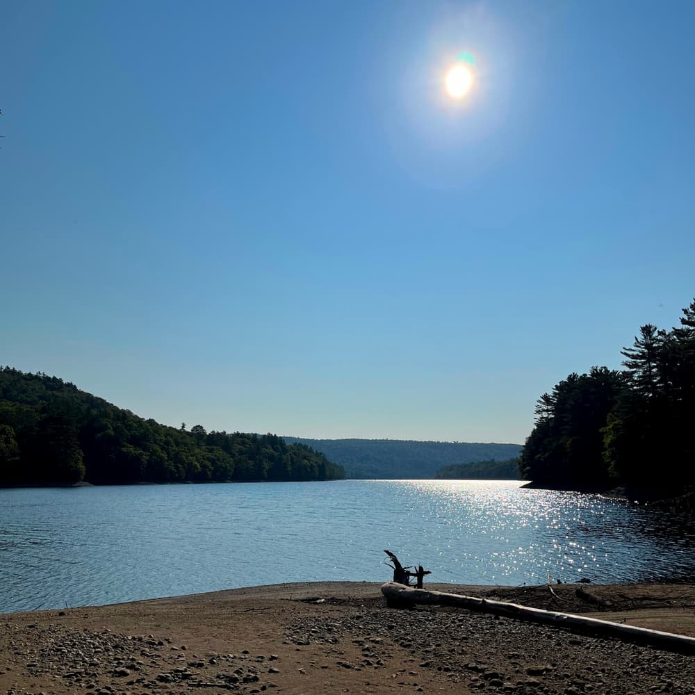
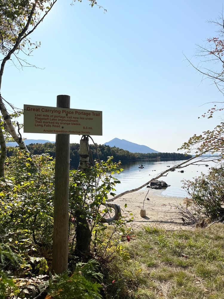
Both ends of the original GCP route unfortunately are now inundated by impoundments. However, most of the trail can still be followed.
For more detailed information about the route's history, read Kenneth Roberts' March to Quebec, a compilation and analysis of the many journals of the soldiers; or read his later great historical novel, Arundel.
For additional information, visit the Arnold Expedition Historical Society website, or contact:
Arnold Expedition Historical SocietyThe east end of the Great Carrying Place (GCP) Portage Trail begins on the west Shore of Wyman Lake. To reach this point, travel via US-201 to Bingham, ME. At the south junction of ME-16, turn west ontoME-16 and immediately cross the Kennebec River. At end of bridge turn right (north) onto an unnumbered highway. It is 9 miles north to reach the GCP drop-off point. This route passes through the hamlet of Pleasant Ridge Plantation. Where the road forks, bear right onto the Carry Ponds Road which soon becomes a gravel roadbed. After closely paralleling the west shore of Wyman Lake for several miles, reach the GCP route at a turn-off and prominent AEHS sign on right side of road.
The west end of the Great Carrying Place Portage Trail begins on the east shore of Flagstaff Lake. To get there, follow the Long Falls Dam Road northward from North New Portland which leaves ME-16 at this point. Follow Long Falls Dam Road north for 21 miles. Leave cars at the prominent AEHS sign at the junction of Loing Falls Dam Road and the gravel Spring Road which turns eastward. This is also a prime point to pick up hikers traveling westward from the other end. Walk downhill northward along Long Falls Dam Road for 75 yards, then turn left, leaving road. Cross a wide logging yard area then reenter woods on an old tote road. The route is marked by orange blazes. It leads 0.3 miles to the shore of the lake and the west end of the GCP Portage Trail.
Success! A new password has been emailed to you.