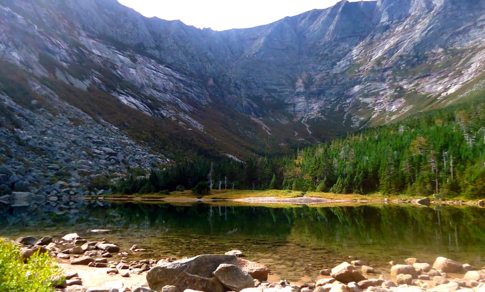
Chimney Pond Trail (3.3 miles)
This is the main trail used to reach most of the other trails around the Great Basin, and it also serves as a connector between Roaring Brook and Chimney Pond Campgrounds. It is heavily used. It follows an old logging-era tote road west, ascending along Roaring Brook to Basin Ponds. There are two Basin Ponds, but the trail only touches the lower (southerly) one. The trail then ascends into the Great Basin through its horseshoe opening, and ends at the campground on the shore of Chimney Pond. The total elevation gain is 1,425 feet.
Helon Taylor Trail (3.2 miles)
This trail is the shortest possible approach from Roaring Brook Campground to the high peaks and above treeline climbing on Katahdin. The trail begins near Roaring Brook Campground and ascends Keep Ridge for most of its distance. It terminates at Pamola Peak, the southeast side of the Great Basin. It is an extremely exposed trail, so hikes should not be attempted in bad weather. It can be combined as a loop trip using the Dudley Trail and Chimney Pond Trail to return to Roaring Brook. It may also be used as an ascent to Baxter Peak via the Knife Edge, down the Saddle Trail, then down the Chimney Pond Trail. All of these routes are long, very hard hikes, most of which are above tree line. They should be attempted only by strong parties. The elevation gain to Pamola Peak is 3,413 feet and is a difficult, rocky climb.
Dudley Trail (2.4 miles)
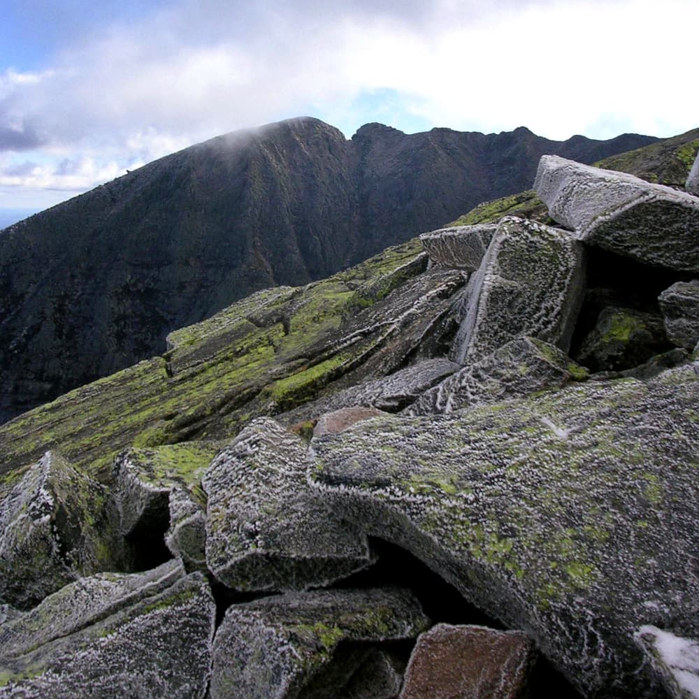
This is the most easterly of the four ascent trails leading from Chimney Pond to the rim of the Great Basin (Cathedral, Saddle, and Hamlin Ridge Trails being the others). It is a short, but very steep, climb to reach Pamola Peak, the most easterly of the peaks ringing the Great Basin. The trail is almost entirely above treeline, and is a part of the most favored circuit trip in the Park: ascending the Cathedral Trail to Baxter Peak, across the Knife Edge, and then down the Dudley Trail back to Chimney Pond Campground. It also can be utilized as an exciting day loop trip ascending from Roaring Brook Campground using the Chimney Pond Trail, then up the Dudley to Pamola Peak, then down the Helon Taylor Trail back to Roaring Brook Campground. The Dudley Trail’s elevation gain is 1,988 feet from Chimney Pond to Pamola Peak. The summit is 4,902 feet.
Cathedral Trail (1.5 miles)
The Cathedral Trail offers the shortest, but steepest, climb from a campground to Baxter Peak. Descending this trail is not recommended. Known for its cathedral like rock formations and quick elevation gain, this trail is very exposed and precipitous. It is very steep climbing over three large rock buttresses that have many vertical fissures giving them the appearance of columns. The climbing is almost all above tree line. The elevation gain from Chimney Pond to Baxter Peak is 2,353 feet, which includes an additional 0.2 miles on the Saddle Trail from the Cathedral Trail to Baxter Peak.
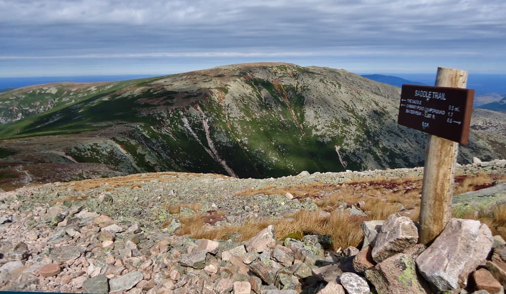
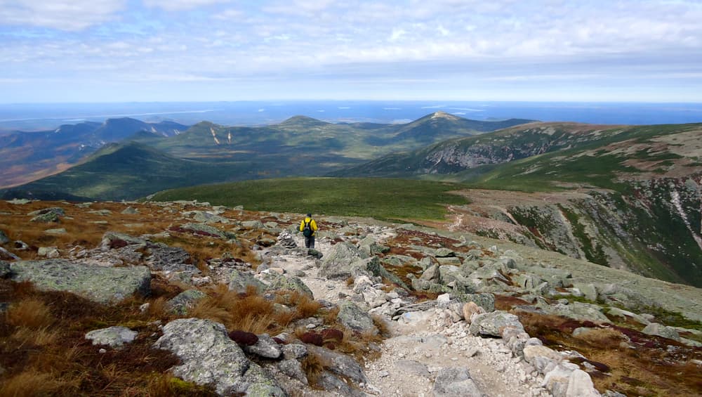
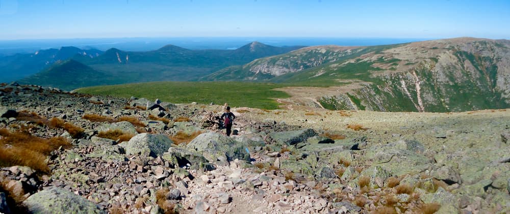
Saddle Trail (2.2 miles)
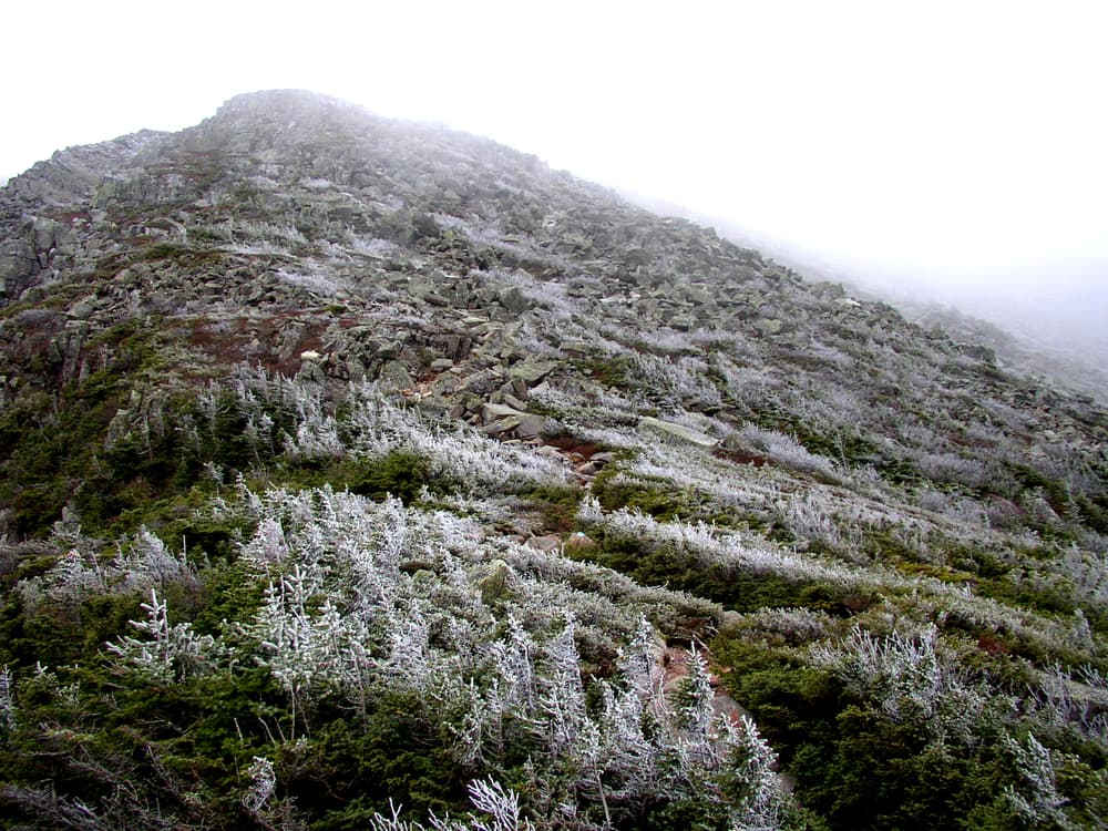
Of the four steep and rocky trails leading from Chimney Pond Campground to Baxter Peak, this the least steep, using the prominent slide on the west wall of the Basin. Historically, it is one of the older routes for the ascent of Katahdin. It is named the Saddle Trail because it reaches the Great Basin’s ridge at its lowest point. The Saddle Slide is a steep portion of the trail that is comprised of loose gravel and rocks. Hikers should always use caution and be wary of dislodging rocks in the slide. At the top of the slide, the Saddle Trail continues across the Tablelands to Baxter Peak. This trail is also the best route to the Northwest Basin, Northwest Plateau, or Hamlin Ridge. The net elevation gain from Chimney Pond to Baxter Peak is 2,353 feet.
Hamlin Ridge Trail (1.5 miles)
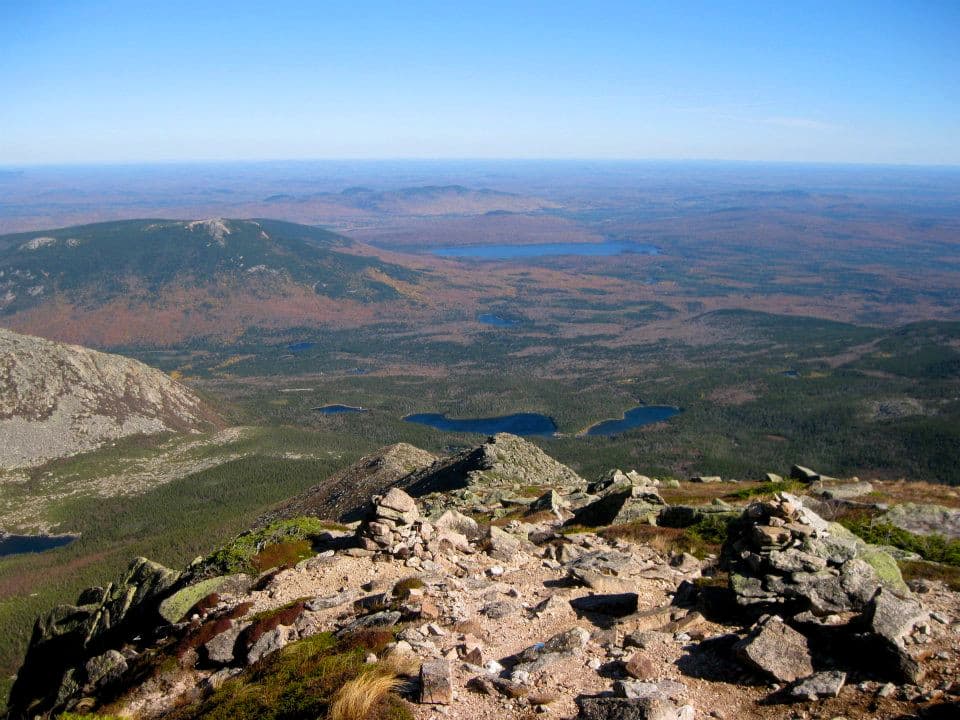
Hamlin Ridge is a long, open ridge that separates the Great Basin and the North Basin. For that reason, the Hamlin Ridge Trail offers outstanding views into both cirques. It begins on the North Basin Trail, 0.7 miles east of Chimney Pond Campground. It then ascends a long ridge to Hamlin Peak, beyond descending to its terminus at Caribou Spring and at the junction of the Northwest Basin Trail. The net elevation gain is 1,837 feet. from Chimney Pond to Hamlin Peak.
The Knife Edge (1.1 miles)
The Knife Edge is a narrow arête between South and Pamola Peaks. It is a glacially-formed feature that has no equal in the Appalachian Mountains. The route is very exposed, with severe vertical drops on either side of the narrow trail, and is not for those with a fear of heights. The Knife edge should only be attempted by experienced hikers and in favorable conditions. See the Trail Alert tab for more information.
North Basin Trail (1.2 miles)
This is a short trail which leaves the Chimney Pond Trail 0.3 miles east of the Chimney Pond Campground. It ascends along a flank of Hamlin Ridge. At 0.4 miles the Hamlin Ridge Trail turns left (north) and the North Basin Trail continues to the right. At 0.9 mi. the North Basin Cut-off descending to Basin Ponds enters from right (east). The trail ends on Blueberry Knoll with great views into the North Basin. Blueberry Knoll itself is a good example of a well-developed glacial moraine.
Please note: in the trail map, the white dotted lines depicted are the trails shown by the Google basemap and are inaccurate; the orange lines are the correct trails.
Park Fees: See website for entrance and camping fees. [No entrance fee for Maine residents.]
Park Rules: See a more complete list here.
For additional information, visit the Baxter State Park website, or contact:
Baxter State Park AuthorityThese trails are all accessed from Roaring Brook Campground, which is reached via the Togue Pond Gatehouse (South Gate) of Baxter State Park.
From downtown Millinocket, travel 16 miles northwest on the paved Baxter Park Road to the Togue Pond Gatehouse, passing buildings and the Golden Road Crossing after eight miles. After entering the park at Togue Pond Gate, bear right and continue onto the Roaring Brook Road for 7.9 miles. Roaring Brook Road ends at Roaring Brook Campground. Park in the day-use lots straight ahead if not camping. The trailheads are located at the north end of this parking area near the Roaring Brook Ranger Station.
Please note: If not camping, hikers parking at Roaring Brook Campground to hike these trails should obtain reservations in advance. The Togue Pond Gate opens at 6AM. If you have a parking reservation, it will be held until 7AM. If you don’t show up by 7AM, the spot becomes first-come, first served at that time.
Success! A new password has been emailed to you.