
Hey fellow hikers! It's been a while since I last posted about my adventures. I've definitely been busy this year with lots of other work. Recently, I ventured out with my MTF colleagues, Kara and Hope. We are always trying to improve the information we provide to users of MTF, so we ventured out to Brown Woods in Bangor for a little training and brainstorming session.
We discussed the need for more accurate ways of obtaining the data we present on MTF. We explored methods to find running and cross slope, how to better document barriers or obstacles, and how often we should take data samples—should it just be when we see something noticeable?
When we arrived at Brown Woods, we jumped right into the discussion. How did we want to proceed? First, we looked at the trailhead. What is the parking like? Is there a bathroom? Is there lighting? Is there a public transportation stop? Is there bike parking? What is the kiosk like? What is the signage in general like? Geez, that's a lot of questions, and we hadn’t even approached the trail yet.

As you can see, this gets pretty complicated very quickly. All of those things are valid points that people might want to know about before they leave home. We are thinking icons on the map with notes might work to share the information, or maybe different description formats.
The trail assessment is a whole other thing to figure out. Do we take measurements at a certain interval? Do we only take measurements when there is an obvious change in the trail? Do we document every single rock and root? Do we just say there are rocks and roots present over a certain size? Do we document every cross slope or just the worst case? Do we document every running slope or just the worst case?
The standards for certain trail organizations, mostly federal, require that at least the following be listed on signage:
We definitely agree with this list, but then how precise do we need to be for general trail users? Is it okay to just give a range for the typical slope, such as 5%-8%, or do we need to say 7.7%? I would argue that the range is more useful, along with the maximum.
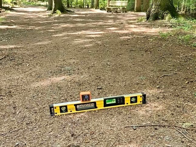
I recently did another job where one of the people brought along a level with a built-in digital readout of angle in degrees and percentage. I came right home and ordered one for just this purpose. Hope and Kara also brought different devices. We decided to see if we got the same result with each device. We found that we didn’t. This was mostly due to the perfect imperfection of nature.
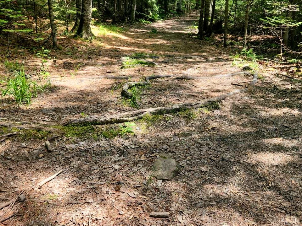
A slope is never going to be evenly distributed over a certain distance. There are going to be rocks and roots and dips and hills between any two points. Those points may run parallel to each other, but may have vastly different results.
So now the question becomes how do you decide where to take the measurements? In my mind, I would look for the worst-case scenario or the steepest-looking angle. On a side note, Kara decided to test my eyes and asked me what I thought the angles were before she told me. 100% of the time, I was within less than a percent of the grade. Obviously, not everyone can do that, but it was good to know that the information I have been giving was fairly accurate.
The next measurement we struggled with was measuring the length of a running slope. Do people need to know that the 10% slope runs for over 100 feet? Well, people who might place benches along a trail to enable people to rest would need to know that, since the standards call for a bench every 30 feet when the slope is 10%. I would have thought that was going way overboard and simply would put one maybe at the top and bottom of the slope. There were actually two slopes on this trail over 10% that ran for well over 100 feet.
Another question that arose was how do you represent all of this information on a map? Do we use icons, different colored lines, or some combination? We thought maybe different types of lines for things that occurred over a distance and then different icons for things that occur at a point.
We definitely left this trail with more questions than answers, but at least now we know the questions we need to figure out. We would also love to hear what you have to say! Leave us a comment below or email us to let us know what information you would like and how to best present it. After all, we do this for you, the people who use MTF.
If you have a different type of mobility issue or a different disability and you visit this trail or others, please comment on this post and give us your feedback. The more knowledge we gather and share, the more people we can get outside using the trails of Maine!
Success! A new password has been emailed to you.