The Penobscot River Paddling Trail runs from Medway to Bucksport on the fabled Penobscot River. The Penobscot River Paddling Trail eleven campsites approximately every 10 river miles, enabling users to paddle and camp from the upstream East Branch to the Maine Island Trail along the coast. For detailed information about the reaches of the river, and to learn more about the river's natural and cultural history, visit the Penobscot River Paddling Trail website.
Please note, the islands from Mattaseunk Dam to Indian Island in Old Town are all property of the Penobscot Nation; prior permission from the tribe is required to land on them.
Put in at the boat launch in Medway on ME-157, at the confluence of the east and west branches of the Penobscot. At 4.5 miles, the river passes Faith Island, which was a peninsula until the Mattaseunk Dam ponded it in 1949.
The paddle from Medway is all flatwater due to the dam, and scenic forested lands give a feeling of wilderness. The Mattaseunk Dam is 8 miles into the route, and is portaged river right on a rough trail. Below the dam, frequent riffles and swift current contribute to the ride in this segment. The mouth of the Mattawamkeag River comes in river left at Mile 12, with a gravel bar by its mouth. Shortly, Five Islands Rapids (Class I/II) precedes the Tannery Row Campsite at Mile 15 on river left in Winn. Two miles farther, the Winn Boat Launch is on the left at Mile 17.
Note: This is the longest stretch before reaching a campsite. To shorten it, put in below the Mattaseunk Dam on ME-157 on river left (east side). This shortens the day by 8 miles and avoids a portage.
Easy rapids and small islands are frequent along this stretch, amid a mix of forested and pastoral land. Snow Island is at Mile 19, with Sebonibus Rapids (Class I/II) just beyond. The Chester Bridge Boat Launch is river right at Mile 21. Medunkeunk Landing Campsite at Mile 25 is 0.1 miles up Medunkeunk Stream, riverright, at the top of Mattanawcook Island. This campsite requires advance notice of use by calling or texting (207)-897-8034. Continuing, the next take-out is at the South Lincoln Boat Launch, Mile 30.
The put-in faces high, scenic Mahockanock Island at the start of this segment at Mile 30. In two miles, paddle river left and look for an old car ensconced in the roots of a large silver maple on the riverbank, barely visible. This is at the beginning of Mohawk Rapids (Class I). Below the rapids, at Mohawk Island, paddle river right to reach Mohawk Campsite at Mile 34, behind a bar island and west of Mohawk Island's southern tip.
Continuing down river, over the next 3 miles the river widens and becomes more sluggish. Merrill Brook Cabins and a boat launch are on river right just upstream of the West Enfield Dam. Merrill Brook Cabins will let you camp on their lawn for a fee. The portage requires taking out at this boat launch, walking 0.4 miles down the road, and circling outside a chain link fence. For a shorter portage around the dam, paddlers may call (207) 447-8256 to ask to have the chain link fence opened.
After the West Enfield Dam, the Piscataquis River comes in from river right, through a passage created for migrating fish. It is 1.5 miles more to the Tannery Park Boat Launch at Mile 40.
From Tannery Park Boat Launch in Howland at Mile 40, the river has several islands, some natural, and some resulting from boom islands made for logging. Pass the Passadumkeag River Boat Launch and Point
Passadumkeag Campground at Mile 44. For a fee, you can camp there, use showers, laundry, resupply in the store, and buy short-order meals.
The next PRPT campsite is river left at Mile 48 at Nibezun, a Wabanaki owned traditional meeting ground. A Medicine Trail can be explored near the campsite. Please respect ceremonies and other events in session by not
intruding. After Nibezun, Olamon Island is on river left, then some large islands. Paddle river right to look for Riverbilly’s Retreat Campsite at Mile 54 in Argyle, opposite Foster Island. From there, back to river left, the Greenbush Boat Launch is at Mile 55.
The Greenbush Boat Launch is at Mile 55, and the Costigan Boat Launch at Mile 58 in north Milford. At Mile 60, Sunkhaze Stream comes in from river left, just above a split where the river divides into two channels: the main stem to the left (straight ahead), and the Stillwater Branch to the right, at Mile 61. Ketawamkihtek is the Penobscot name for this branch, and also the name of the campsite 0.25 miles in on the right.
To continue down the river, backtrack the 0.25 miles and return to the main stem, passing Orson and Socks Islands and coming to Indian Island, the main community of the Penobscot Nation. The safest, most direct route to proceed is between Orson Island and the west side of Indian Island, as there are ledge drops and rapids at Joe Pease Rips to the east of Indian Island.
The Old Town Boat Launch at Mile 62 is a good end point to avoid portaging the Milford Dam. If you are continuing downriver, there are portage trails on both banks of the river, neither well marked. Past the dam, French Island in mid-river at Mile 63. There are rapids on both sides to paddle through, but the traditional path is to paddle Shad Rips around the east (left) side of the island. SW French Island Campsite is at the SW tip of the island at Mile 64.
If Old Town is where you want to put in, you can avoid the portage of the Milford Dam by lowering your boat down from the walkway at Binette Park, Mile 62, where there is a small island upstream of French Island. The
traditional path around French Island is river left through Shad Rips, Class I/II. The right channel around French Island has ledge drops that are sometimes dry. SW French Island Campsite is at the SW tip of the island at Mile 64, one mile above the biggest rapid on the main stem of the Penobscot: Great Works Rapids, Class II/III depending on water levels. Portage on river left.
At Mile 69, the Stillwater River comes in at Basin Mills Rapids (Class II/III), a close second to Great Works for intensity, and with a portage trail river right. From there the Orono Boat Launch is river right at Mile 70.
From the Orono Boat Launch at Mile 70, it is one mile to Oak Glen Campsite, river right, on property of the Penobscot Valley Country Club. Class I/II rapids make up the 2 miles to the Eddington Boat Launch, river left at Mile 72. This is followed by Veazie Rapids, at the site of the former Veazie Dam. Stay river right for the best line. These Class II/III rapids can be challenging in medium or high water. Another half-mile of easier rapids leads to Eddington Bend, the highest extent of tidal influence on the river.
There is a boat launch at the Eddington Salmon Club, river left, and another in less than 2 miles, river left in North Brewer. From there it is 2 miles to the former Bangor Dam, Class I/II rapids. On river left, just past an old dam abutment, is the Penobscot Salmon Club Campsite at Mile 76. The river is tidal from here down to the sea.
One mile down, on both sides of the river, there are small hand-carry boat launches in Bangor and Brewer for those who want to dine out (or resupply at Tozier’s Market in Brewer.) Hamlin’s Marina is river right at Mile 80, with a parking lot, boat launch, restrooms for paddlers, restaurant and take-out food.
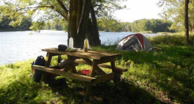
Put in at Hamlin’s Marina, Mile 80, which is best on a high tide falling. Wind upriver can be very challenging. Sturgeon Leap Campsite is at Mile 85, river left in Orrington. (Yes, do sit at the picnic table and watch for leaping sturgeon!) The South Orrington Boat Launch is at Mile 87.
Try to start on a high tide falling from the South Orrington Boat Launch at Mile 87. The river widens considerably and can get whitecaps and swell from a seabreeze. From here it is 7 miles to the wide opening of Marsh Bay, river right. Along this stretch there are good views of Mt. Waldo, a 1064-foot-high granite dome to the right. Its name Kinahpskatenek means “Where there is a big bouldery mountain.” If the tide is not to low, on the right, upstream of the bay, Treat Point is a nice place to explore, part of Mendall Marsh, an Inland Fisheries and Wildlife preserve open to the public for day-use.
The Frankfort Boat Launch is on the highway beside the bay interior. Marsh Bay is the joining of the North Branch of the Marsh River, not easily canoeable upstream, and the South Branch of the Marsh River, which is a
lovely tidal paddle 4 miles one-way. With 3 hours to spare, and on a rising tide, it is fun to paddle upstream (south) with the tide’s help to its head at a railroad trestle, and then back down on the falling tide. Watch for many
warbler species, marsh wren, saltmarsh sharptail sparrow, kingfisher, osprey, eagle, merganser and other duck species. .
In its millions of years of evolution, the lower Penobscot has changed course several times. The South Branch of the Marsh River was at one time the main channel of the river, but during glacial periods it was blocked by moraines and the river changed course. The South Branch of the Marsh River has been preserved as Mendall Marsh, hemmed in by Bowden Point, the large high peninsula in Prospect.
Ferry Landing Campsite is river right on the main river (not in Marsh Bay) about 2 miles down Bowden Point. There is a granite block point jutting into the river, the former ferry landing. Past the granite point, there is a
large fallen oak tree, river right. Just past the tree, a set of stairs leads up to the campsite on the bluff.
To take out at Bucksport or Verona, it isw about 3 more miles to the town wharf, and another half mile to the Verona Island boat launch. The river stays wide and windy most of the way before narrowing between the industrial site, river left, and Fort Knox, river right. The fort was built in 1844 of Mt. Waldo granite in response to border disputes with British Canada, to protect the Penobscot Valley from possible British naval attack, but was never used except for training. It was deeded by the US government to the State of Maine for public use in 1923.
For additional information, visit the Penobscot River Paddling Trail website, or contact:
![]()
NORTHERN TERMINUS, MEDWAY BOAT LAUNCH
Take exit 244 off I-95. Head west on ME-157 for 1 mile, and turn right into the recreation area to the boat launch.
SOUTHERN TERMINUS, VERONA ISLAND BOAT LAUNCH
The Verona Island Public Landing is located just off US-1 at the north end of Verona Island, 0.3 miles south of the intersection with Main Street in downtown Bucksport, and 1 mile north of the Penobscot Narrows bridge.
Success! A new password has been emailed to you.