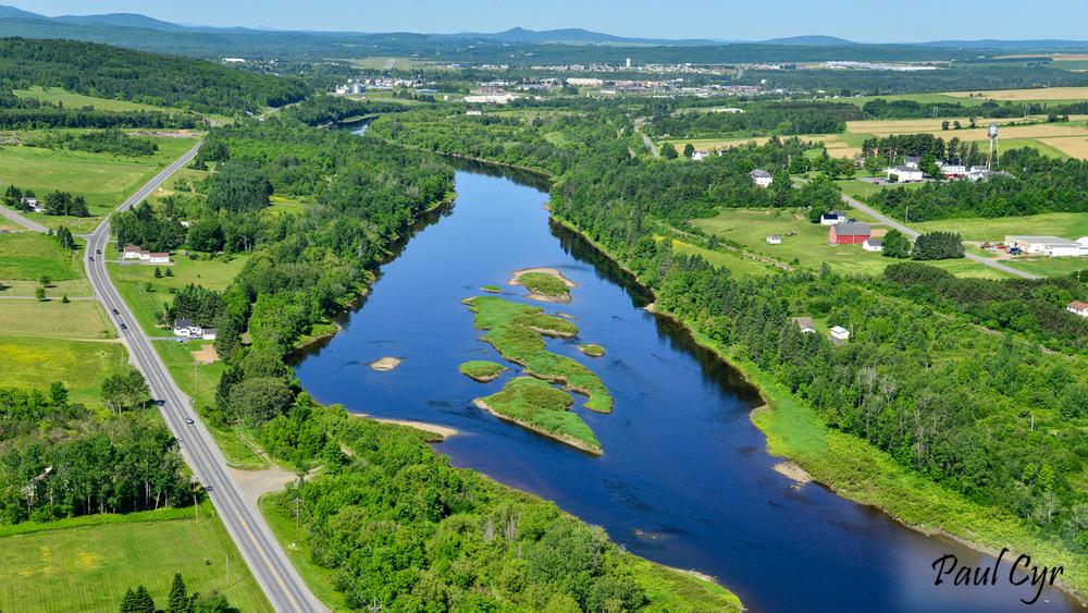
Known as “The Reach,” most of this section of the Aroostook flows due north from Presque Isle to Caribou. The relatively flat water with few small rips is great for beginners, but this leg is a bit longer than most and can be strenuous on breezy days. Early in the season, there are good opportunities for brook trout fishing below the mouths of numerous coldwater streams that enter the river along this stretch.
From the boat launch at US-1 in Presque Isle, the river flows easterly for about 2.5 miles before gently swinging north. There are some low islands after 2 miles, near the mouth of Merritt Brook entering on the south. In low water, run to the left of these.
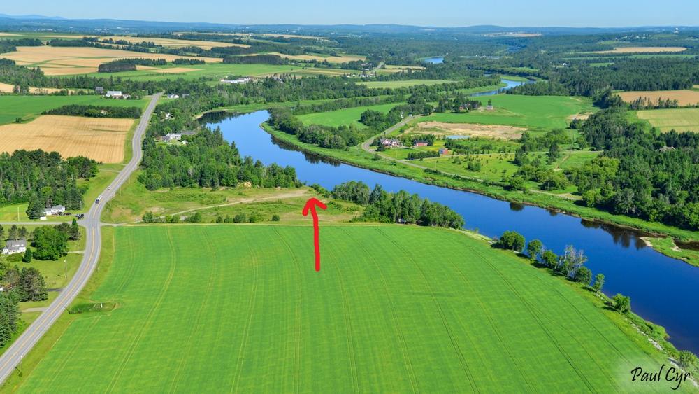
The latter half of the trip is quieter as the roads pull away from the river. There are some small riffles below the mouth of Hardwood Brook, but flatwater thereafter. The last 2.5 miles are flatwater on the impoundment above the dam. Watch for the takeout on the west (left) bank. It is located about 0.3 miles above the dam, well before the power plant.
Caution: Though a safety boom is typically moored across the river above the dam, it is removed in fall and replaced in spring after ice out. Early or late season paddlers may not encounter this warning structure and the current can be swift here in high water.
For additional information, visit the Aroostook County Tourism website, or contact:
![]()
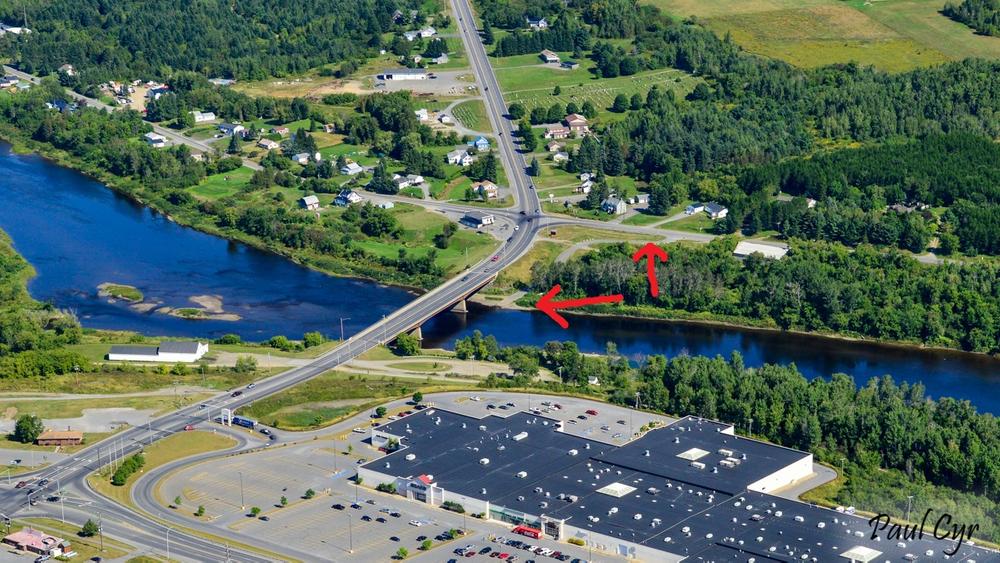
PUT-IN AT PRESQUE ISLE
Head north on US-1 through Presque Isle. Take the first right after the bridge over the Aroostook River to the boat launch, just before Reach Road.
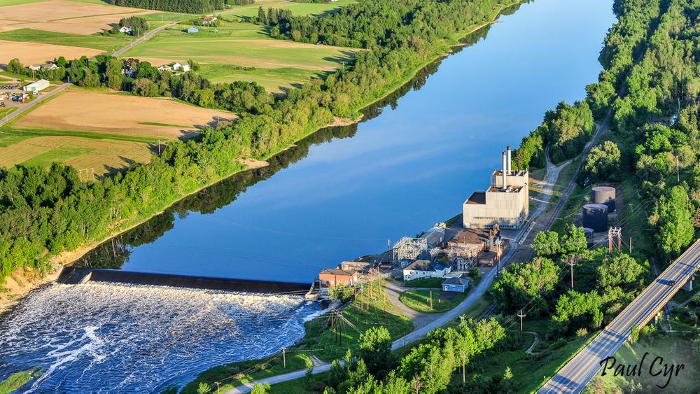
TAKE-OUT AT CARIBOU
From the junction of US-1 and Fort Street in Caribou, head north on US-1 for about 250 feet and take a right onto Lower Washington Street. Go 485 feet and turn right onto Lower Lyndon Street. Follow Lower Lyndon Street south under the bridge toward the old power plant.
The access road goes right beside the buildings and “No Tresspassing” signs can be discouraging, but public access is established and (somewhat) maintained. After the plant, the road turns to dirt and splits. Either route will lead to the landing. The track is rough, with deep puddles in places, but even two-wheel drive vehicles should be able to access the launch at the end.
Parking is limited close to the river, but there is a small clearing at the top of the bank where a vehicle can be left.
Success! A new password has been emailed to you.